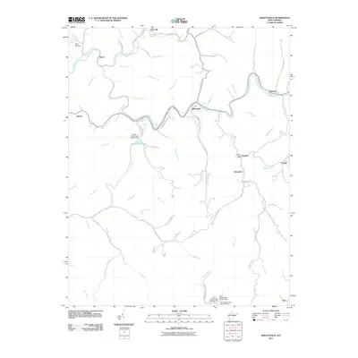
2011 Map of Baileysville
USGS Topo · Published 2011About this map
The Guyandotte River carves a winding path through this Wyoming County landscape, anchoring settlements like Baileysville and Brenton along its banks. The topography is defined by a dense network of branches and forks, including Clear Fork and Indian Creek, which historically dictated the placement of mountain communities and roads. Infrastructure development is evident in the multiple water control structures, notably Horse Creek Dam Number One creating Horse Creek Lake and the series of dams at Twin Branch Dam Number One, Two, and Three near the southern border. Smaller hamlets such as Fanrock, which retains its Fanrock Post Office, and Stoneville sit along these narrow valley corridors, illustrating the localized settlement patterns of the West Virginia coalfields in the early 21st century.
Find a feature on this map
69 named features on this map. Tap any name to fly to it.
Don’t see what you’re looking for? This feature index may not catch every label — zoom into the map to look around manually.
Map Details
Editions of this 2011 Baileysville Map
This is the sole edition of this map. No revisions or reprints were ever made.
Other maps of this area

1891 · Tazewell
USGS Topo · 1:125,000

1891 · Oceana
USGS Topo · 1:125,000

1893 · Oceana
USGS Topo · 1:125,000

1895 · Tazewell
USGS Topo · 1:125,000

1897 · Tazewell
USGS Topo · 1:125,000

1898 · Oceana
USGS Topo · 1:125,000

1909 · Gilbert
USGS Topo · 1:48,000

1910 · Pineville
USGS Topo · 1:48,000

1910 · Iaeger
USGS Topo · 1:48,000

1912 · Gilbert
USGS Topo · 1:62,500