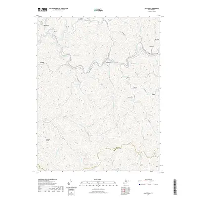
2019 Map of Baileysville
USGS Topo · Published 2019About this map
Baileysville and Brenton serve as central points in this portion of Wyoming County, where the Guyandotte River carves a winding path through the southern West Virginia coalfields. The map illustrates a landscape defined by narrow valley settlements and steep ridges, including Indian Ridge and Mill Ridge. The presence of the Guyandotte Water Trail reflects the importance of the river for modern recreation, while place names like Splashdam Hollow hint at the area's industrial history in timber and water management. Smaller communities such as Sun Hill, Stoneville, and Fanrock are connected by a network of rural routes like CO Hwy 8 and CO Hwy 14, tracing the natural contours of the creek beds. To the west, the Horse Cr Lake provides a notable break in the dense network of hollows like Barn Hollow and Reedy Br.
Find a feature on this map
80 named features on this map. Tap any name to fly to it.
Don’t see what you’re looking for? This feature index may not catch every label — zoom into the map to look around manually.
Map Details
Editions of this 2019 Baileysville Map
This is the sole edition of this map. No revisions or reprints were ever made.
Other maps of this area

1891 · Tazewell
USGS Topo · 1:125,000

1891 · Oceana
USGS Topo · 1:125,000

1893 · Oceana
USGS Topo · 1:125,000

1895 · Tazewell
USGS Topo · 1:125,000

1897 · Tazewell
USGS Topo · 1:125,000

1898 · Oceana
USGS Topo · 1:125,000

1909 · Gilbert
USGS Topo · 1:48,000

1910 · Pineville
USGS Topo · 1:48,000

1910 · Iaeger
USGS Topo · 1:48,000

1912 · Gilbert
USGS Topo · 1:62,500