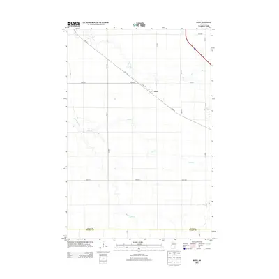
2013 Map of Baker
USGS Topo · Published 2013About this map
Baker and its local post office, PO Baker, serve as the central hub of this agricultural landscape along the western edge of Minnesota. The terrain is defined by a dense network of slow-moving waterways, including the winding course of the S Br Buffalo River and its tributaries such as Whisky Cr and Stony Creek. These drainage patterns shape the grid of rural roads, including Co Hwy-52, which cuts diagonally across the section lines.
Find a feature on this map
19 named features on this map. Tap any name to fly to it.
Don’t see what you’re looking for? This feature index may not catch every label — zoom into the map to look around manually.
Map Details
Editions of this 2013 Baker Map
This is the sole edition of this map. No revisions or reprints were ever made.
Other maps of this area

1895 · Fargo
USGS Topo · 1:125,000

1897 · Fargo
USGS Topo · 1:125,000

1919 · Barnesville
USGS Topo · 1:62,500

1919 · Hawley
USGS Topo · 1:62,500

1952 · Barnesville
USGS Topo · 1:62,500

1953 · Fargo
USGS Topo · 1:250,000

1956 · Fargo
USGS Topo · 1:250,000

1964 · Sabin
USGS Topo · 1:24,000

1964 · Baker
USGS Topo · 1:24,000
1964 · Glyndon South
USGS Topo · 1:24,000