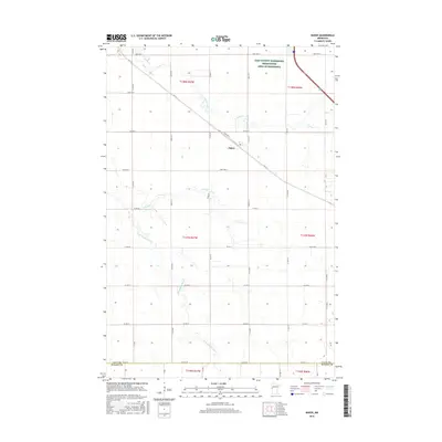
2016 Map of Baker
USGS Topo · Published 2016About this map
Baker stands as the central settlement on this Clay County prairie, situated along the diagonal path of Hwy-52. The landscape is defined by the subtle drainage patterns of the Red River Valley, where the S Br Buffalo River and several smaller streams like Whisky Cr, Stony Cr, and Hay Cr meander through the agricultural grid. These waterways reflect the characteristic hydrologic features of the region, providing vital drainage for the surrounding farmland. To the north, the Clay County Waterfowl Production Area of Minnesota preserves a portion of the natural prairie wetland habitat. The map also delineates the southern boundary where the county line meets Wilkin County, illustrating the transition between these two farming-intensive jurisdictions.
Find a feature on this map
15 named features on this map. Tap any name to fly to it.
Don’t see what you’re looking for? This feature index may not catch every label — zoom into the map to look around manually.
Map Details
Editions of this 2016 Baker Map
This is the sole edition of this map. No revisions or reprints were ever made.
Other maps of this area

1895 · Fargo
USGS Topo · 1:125,000

1897 · Fargo
USGS Topo · 1:125,000

1919 · Barnesville
USGS Topo · 1:62,500

1919 · Hawley
USGS Topo · 1:62,500

1952 · Barnesville
USGS Topo · 1:62,500

1953 · Fargo
USGS Topo · 1:250,000

1956 · Fargo
USGS Topo · 1:250,000

1964 · Sabin
USGS Topo · 1:24,000

1964 · Baker
USGS Topo · 1:24,000
1964 · Glyndon South
USGS Topo · 1:24,000