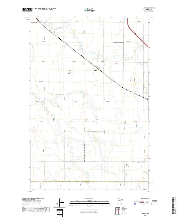
2022 Map of Baker
USGS Topo · Published 2022About this map
Baker sits at the center of this agricultural landscape in Clay County, positioned along the diagonal route of Hwy 52. The township is defined by a grid of rural sections, primarily bounded by numbered avenues and streets that facilitate the movement of goods through this portion of the Red River Valley. The hydrology of the region is prominent, with the S Br Buffalo River winding through the southern half of the quadrangle and smaller tributaries like Whisky Cr and Stony Creek draining the northern reaches. The transition between Clay Co and Wilkin Co at the southern margin, marked by Co Rd 192, highlights the jurisdictional boundaries of this farming district. These waterways and road networks suggest a landscape dominated by large-scale cultivation and small prairie settlements established along early transportation corridors.
Find a feature on this map
37 named features on this map. Tap any name to fly to it.
Don’t see what you’re looking for? This feature index may not catch every label — zoom into the map to look around manually.
Map Details
Editions of this 2022 Baker Map
This is the sole edition of this map. No revisions or reprints were ever made.
Other maps of this area

1895 · Fargo
USGS Topo · 1:125,000

1897 · Fargo
USGS Topo · 1:125,000

1919 · Barnesville
USGS Topo · 1:62,500

1919 · Hawley
USGS Topo · 1:62,500

1952 · Barnesville
USGS Topo · 1:62,500

1953 · Fargo
USGS Topo · 1:250,000

1956 · Fargo
USGS Topo · 1:250,000

1964 · Sabin
USGS Topo · 1:24,000

1964 · Baker
USGS Topo · 1:24,000
1964 · Glyndon South
USGS Topo · 1:24,000