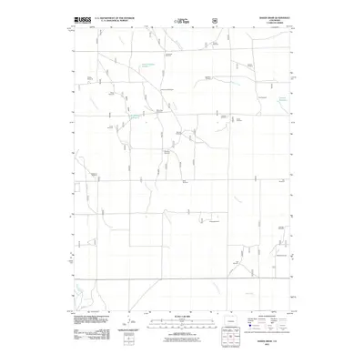
2011 Map of Baker Draw
USGS Topo · Published 2011About this map
Baker Draw defines the drainage of this arid landscape, where survival and settlement depend on a network of water management features and windmills. This 2011 survey illustrates the importance of water storage in northern Colorado through sites like Sand Reservoir Number 1, Sand Reservoir Number 2, and Howard Reservoir. The infrastructure is heavily focused on ranching and agricultural viability, evidenced by the high density of named windmills scattered across the plains.
Find a feature on this map
32 named features on this map. Tap any name to fly to it.
Don’t see what you’re looking for? This feature index may not catch every label — zoom into the map to look around manually.
Map Details
Editions of this 2011 Baker Draw Map
This is the sole edition of this map. No revisions or reprints were ever made.
Other maps of this area

1908 · Eaton
USGS Topo · 1:125,000

1910 · Eaton
USGS Topo · 1:125,000

1954 · Greeley
USGS Topo · 1:250,000

1957 · Greeley
USGS Topo · 1:250,000

1958 · Greeley
USGS Topo · 1:250,000

1960 · Purcell
USGS Topo · 1:24,000
1960 · Galeton
USGS Topo · 1:24,000

1961 · Greeley
USGS Topo · 1:250,000

1964 · Greeley
USGS Topo · 1:250,000

1965 · Greeley
USGS Topo · 1:250,000