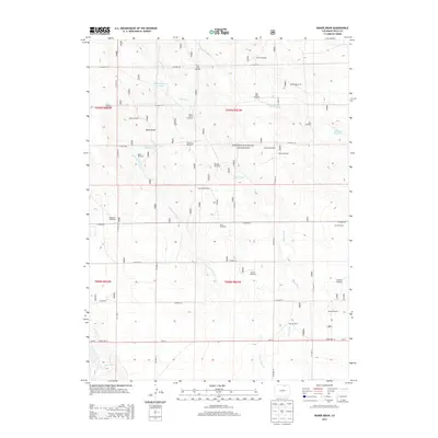
2013 Map of Baker Draw
USGS Topo · Published 2013About this map
Pawnee National Grassland dominates this high-plains landscape in Weld County, where a network of ephemeral watercourses and named windmills reveals the critical importance of water management in a semi-arid environment. The terrain is defined by the namesake Baker Draw and several drainage systems, including Howard Creek, Sand Creek, and Little Sand Creek. Man-made water storage is evident at Sand Reservoir Number 1 and Sand Reservoir Number 2, which likely support the region's agricultural and grazing activities.
Find a feature on this map
41 named features on this map. Tap any name to fly to it.
Don’t see what you’re looking for? This feature index may not catch every label — zoom into the map to look around manually.
Map Details
Editions of this 2013 Baker Draw Map
This is the sole edition of this map. No revisions or reprints were ever made.
Other maps of this area

1908 · Eaton
USGS Topo · 1:125,000

1910 · Eaton
USGS Topo · 1:125,000

1954 · Greeley
USGS Topo · 1:250,000

1957 · Greeley
USGS Topo · 1:250,000

1958 · Greeley
USGS Topo · 1:250,000

1960 · Purcell
USGS Topo · 1:24,000
1960 · Galeton
USGS Topo · 1:24,000

1961 · Greeley
USGS Topo · 1:250,000

1964 · Greeley
USGS Topo · 1:250,000

1965 · Greeley
USGS Topo · 1:250,000