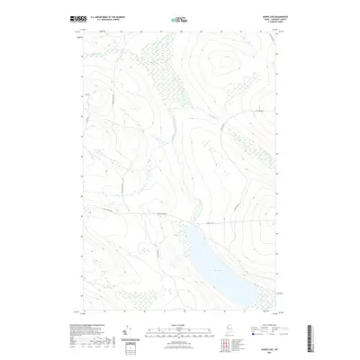
2021 Map of Baker Lake
USGS Topo · Published 2021About this map
Baker Lake dominates the southern landscape of this Somerset County wilderness, serving as the headwater for the Baker Branch Saint John River. The terrain is defined by a dense network of timber and logging access routes, including Saint Aurelie Rd and Baker Lake Rd, which navigate the elevation changes between drainage basins. Several prominent tributaries, such as Brailey Brook and Turner Brook, feed into the river system as it winds northward through the forested interior. This 2021 survey illustrates the modern configuration of Maine's North Woods, where the geography is shaped by the intersection of natural waterways and the commercial infrastructure required to manage the vast timberlands. Topography in the region is characterized by steep ridges and valleys that dictate the winding paths of roads like Foss Pond Rd and Gilbert Rd.
Find a feature on this map
11 named features on this map. Tap any name to fly to it.
Don’t see what you’re looking for? This feature index may not catch every label — zoom into the map to look around manually.
Map Details
Editions of this 2021 Baker Lake Map
This is the sole edition of this map. No revisions or reprints were ever made.
Other maps of this area

1954 · Baker Lake
USGS Topo · 1:62,500

1954 · St. John Pond
USGS Topo · 1:62,500

1954 · Presque Isle
USGS Topo · 1:250,000

1957 · Norris Brook
USGS Topo · 1:62,500

1957 · Hardwood Mountain
USGS Topo · 1:62,500

1958 · Presque Isle
USGS Topo · 1:250,000

1958 · Saint John Pond
USGS Topo · 1:62,500

1960 · Presque Isle
USGS Topo · 1:250,000

1962 · Baker Lake
USGS Topo · 1:62,500

1962 · Quebec
USGS Topo · 1:250,000