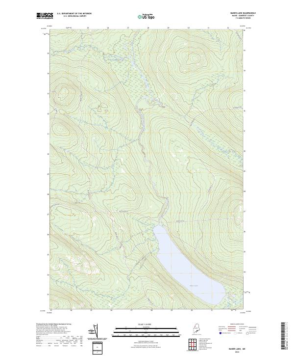
2024 Map of Baker Lake
USGS Topo · Published 2024About this map
The Baker Branch Saint John River winds through this Somerset County landscape, feeding into the northern reaches of Baker Lake. This area of Maine is characterized by its complex network of timber and logging routes, including the prominent Saint Aurelie Rd and Baker Lake Rd, which provide access to the dense woodlands and wetlands. The topography is defined by significant drainage systems such as Brailey Brook and Turner Brook, which flow from the surrounding elevations toward the central river valley. The absence of traditional town centers highlight the region's focus on natural resource management and the preservation of its water systems at the headwaters of the Saint John River.
Find a feature on this map
11 named features on this map. Tap any name to fly to it.
Don’t see what you’re looking for? This feature index may not catch every label — zoom into the map to look around manually.
Map Details
Editions of this 2024 Baker Lake Map
This is the sole edition of this map. No revisions or reprints were ever made.
Other maps of this area

1954 · Baker Lake
USGS Topo · 1:62,500

1954 · St. John Pond
USGS Topo · 1:62,500

1954 · Presque Isle
USGS Topo · 1:250,000

1957 · Norris Brook
USGS Topo · 1:62,500

1957 · Hardwood Mountain
USGS Topo · 1:62,500

1958 · Presque Isle
USGS Topo · 1:250,000

1958 · Saint John Pond
USGS Topo · 1:62,500

1960 · Presque Isle
USGS Topo · 1:250,000

1962 · Baker Lake
USGS Topo · 1:62,500

1962 · Quebec
USGS Topo · 1:250,000