
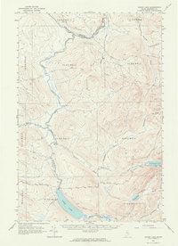
1962 Map of Baker Lake
USGS Topo · Published 1964About this map
The Baker Branch St John River and its labyrinth of feeder streams dominate this 1962 topographical survey of the North Maine Woods. In a landscape defined by industrial timber management, the map reveals a network of private roads and jeep trails threading through unincorporated townships like T 9 R 17 Wels and T 8 R 16 Wels. While largely uninhabited by permanent residents, the Forest Service Camp near the river bend indicates the active stewardship and forestry operations of the era.
Find a feature on this map
29 named features on this map. Tap any name to fly to it.
Don’t see what you’re looking for? This feature index may not catch every label — zoom into the map to look around manually.
Map Details
Editions of this 1962 Baker Lake Map
2 editions found
Other maps of this area

1954 · Baker Lake
USGS Topo · 1:62,500

1954 · Caucomgomoc Lake
USGS Topo · 1:62,500

1954 · Allagash Lake
USGS Topo · 1:62,500

1954 · St. John Pond
USGS Topo · 1:62,500

1954 · Presque Isle
USGS Topo · 1:250,000

1955 · Beaver Pond
USGS Topo · 1:62,500

1955 · Clayton Lake
USGS Topo · 1:62,500

1957 · Norris Brook
USGS Topo · 1:62,500

1957 · Hardwood Mountain
USGS Topo · 1:62,500

1958 · Presque Isle
USGS Topo · 1:250,000