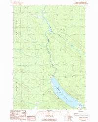
1989 Map of Baker Lake
USGS Topo · Published 1989About this map
Baker Lake dominates this remote section of Somerset County, where the north-flowing St John River system begins its long journey. Surveyed in the late 1980s, the landscape reflects a working forest and wilderness recreation economy, defined by the township boundaries of T 7 R 17 Wels and T 8 R 17 Wels. The map records the infrastructure of the North Woods, featuring the Ranger Sta at the lake's northern tip and a network of Private logging roads that provide the only land access to the interior. The confluence of Turner Brook and the St John River Branch highlights a topography shaped by winding waterways and small upland bogs. Scattered facilities like the Baker Lake North Campsite and Baker Lake South Campsite indicate the area's importance for backcountry transit and seasonal sporting use.
Find a feature on this map
16 named features on this map. Tap any name to fly to it.
Don’t see what you’re looking for? This feature index may not catch every label — zoom into the map to look around manually.
Map Details
Editions of this 1989 Baker Lake Map
This is the sole edition of this map. No revisions or reprints were ever made.
Other maps of this area

1954 · Baker Lake
USGS Topo · 1:62,500

1954 · St. John Pond
USGS Topo · 1:62,500

1954 · Presque Isle
USGS Topo · 1:250,000

1957 · Norris Brook
USGS Topo · 1:62,500

1957 · Hardwood Mountain
USGS Topo · 1:62,500

1958 · Presque Isle
USGS Topo · 1:250,000

1958 · Saint John Pond
USGS Topo · 1:62,500

1960 · Presque Isle
USGS Topo · 1:250,000

1962 · Baker Lake
USGS Topo · 1:62,500

1962 · Quebec
USGS Topo · 1:250,000