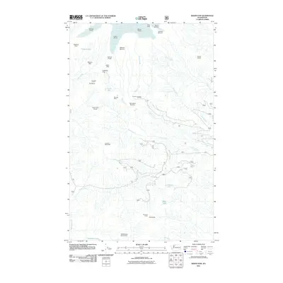
2011 Map of Baker Pass
USGS Topo · Published 2011About this map
Deming Glacier, Easton Glacier, and Squak Glacier dominate the northern elevation of this landscape, defining the drainage patterns for numerous descending creeks. The glacial environment is clearly delineated by features like Sulphur Moraine and Metcalfe Moraine, while the Railroad Grade offers a distinct line across the terrain near Baker Pass.
Find a feature on this map
36 named features on this map. Tap any name to fly to it.
Don’t see what you’re looking for? This feature index may not catch every label — zoom into the map to look around manually.
Map Details
Editions of this 2011 Baker Pass Map
This is the sole edition of this map. No revisions or reprints were ever made.
Other maps of this area

1909 · Mt Baker
USGS Topo · 1:192,000

1915 · Mt. Baker
USGS Topo · 1:250,000

1952 · Lake Shannon
USGS Topo · 1:62,500

1952 · Mt. Baker
USGS Topo · 1:62,500

1952 · Hamilton
USGS Topo · 1:62,500

1953 · Mt Shuksan
USGS Topo · 1:62,500

1955 · Concrete
USGS Topo · 1:250,000

1958 · Concrete
USGS Topo · 1:250,000

1962 · Concrete
USGS Topo · 1:250,000
1973 · Hamilton
USGS Topo · 1:62,500