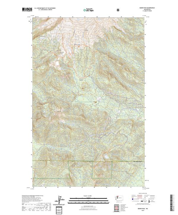
2023 Map of Baker Pass
USGS Topo · Published 2023About this map
Deming Glacier, Easton Glacier, and the Talum Glaciers crown the northern reaches of this terrain, marking the high-elevation sources for the region's complex drainage network. The landscape is defined by its glacial history, with the Metcalfe Moraine and Sulphur Moraine illustrating the path of ice recession across the Mount Baker Wilderness. Toward the center, Schriebers Meadow provides a distinct break in the alpine topography, situated near the headwaters of Rocky Creek.
Find a feature on this map
53 named features on this map. Tap any name to fly to it.
Don’t see what you’re looking for? This feature index may not catch every label — zoom into the map to look around manually.
Map Details
Editions of this 2023 Baker Pass Map
This is the sole edition of this map. No revisions or reprints were ever made.
Other maps of this area

1909 · Mt Baker
USGS Topo · 1:192,000

1915 · Mt. Baker
USGS Topo · 1:250,000

1952 · Lake Shannon
USGS Topo · 1:62,500

1952 · Mt. Baker
USGS Topo · 1:62,500

1952 · Hamilton
USGS Topo · 1:62,500

1953 · Mt Shuksan
USGS Topo · 1:62,500

1955 · Concrete
USGS Topo · 1:250,000

1958 · Concrete
USGS Topo · 1:250,000

1962 · Concrete
USGS Topo · 1:250,000
1973 · Hamilton
USGS Topo · 1:62,500