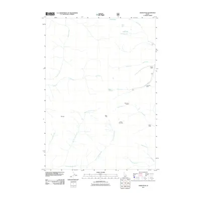
2011 Map of Baker Peak
USGS Topo · Published 2011About this map
Big Peak and Baker Peak anchor this high-elevation landscape in the heart of the Smoky Mountains during the early 21st century. The map reveals a complex network of alpine drainages and remote summits, defined by steep gulches like Brodie Gulch and Lost Shirt Gulch that feed into the larger river systems. Historically significant for its water resources, the area features a high concentration of high-country lakes including Prairie Lakes, Smoky Lake, and Baker Lake. The drainage patterns, particularly those of Big Smoky Creek and the East Fork Big Peak Creek, suggest a terrain shaped by heavy seasonal runoff. This survey provides a precise record of the topography and naming conventions used by the U.S. Geological Survey in this part of Blaine County, including descriptive landmarks such as Slide Rock Canyon and the winding course of Placer Creek.
Find a feature on this map
22 named features on this map. Tap any name to fly to it.
Don’t see what you’re looking for? This feature index may not catch every label — zoom into the map to look around manually.
Map Details
Editions of this 2011 Baker Peak Map
This is the sole edition of this map. No revisions or reprints were ever made.
Other maps of this area

1900 · Sawtooth
USGS Topo · 1:125,000

1955 · Hailey
USGS Topo · 1:250,000

1959 · Hailey
USGS Topo · 1:250,000

1962 · Hailey
USGS Topo · 1:250,000

1964 · Frenchman Creek
USGS Topo · 1:24,000

1970 · Sydney Butte
USGS Topo · 1:24,000

1970 · Paradise Peak
USGS Topo · 1:24,000
1970 · Easley Hot Springs
USGS Topo · 1:24,000

1970 · Dollarhide Mtn
USGS Topo · 1:24,000
1970 · Galena
USGS Topo · 1:24,000