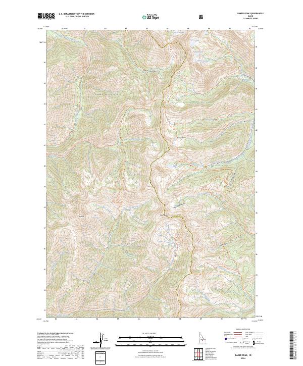
2024 Map of Baker Peak
USGS Topo · Published 2024About this map
Sawtooth National Forest dominates this high-altitude landscape where the Smoky Mountains reach toward prominent summits. The divide between Blaine and Camas counties crosses through Baker Peak, a central landmark for this network of alpine drainages. Water from Big Lost Lake, Smoky Lake, and the Prairie Lakes feeds into a complex system of creeks, including the West Fork Big Smoky Creek and the southern headwaters of Placer Creek. High-elevation passes and steep descents define the topography, notably at Royal Gorge and Slide Rock Canyon. A dedicated network of trails, such as the Osberg Ridgeline Trl and Norton Creek Trl, facilitates movement through the backcountry, while Baker Creek Rd provides limited vehicular access into this otherwise roadless wilderness.
Find a feature on this map
52 named features on this map. Tap any name to fly to it.
Don’t see what you’re looking for? This feature index may not catch every label — zoom into the map to look around manually.
Map Details
Editions of this 2024 Baker Peak Map
This is the sole edition of this map. No revisions or reprints were ever made.
Other maps of this area

1900 · Sawtooth
USGS Topo · 1:125,000

1955 · Hailey
USGS Topo · 1:250,000

1959 · Hailey
USGS Topo · 1:250,000

1962 · Hailey
USGS Topo · 1:250,000

1964 · Frenchman Creek
USGS Topo · 1:24,000

1970 · Sydney Butte
USGS Topo · 1:24,000

1970 · Paradise Peak
USGS Topo · 1:24,000
1970 · Easley Hot Springs
USGS Topo · 1:24,000

1970 · Dollarhide Mtn
USGS Topo · 1:24,000
1970 · Galena
USGS Topo · 1:24,000