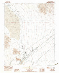
1983 Map of Baker
USGS Topo · Published 1983About this map
The desert outpost of Baker serves as the focal point of this Mojave landscape, situated at the junction of modern infrastructure and remnants of the past. To the north lies the Silver Lake (Site), where a Ruin and a Cem mark the location of an older settlement near the edge of the large dry Silver Lake bed. The transition from rail to highway travel is evident in the Old Railroad Grade that cuts through the valley floor, bypassed by newer transportation routes.
Find a feature on this map
19 named features on this map. Tap any name to fly to it.
Don’t see what you’re looking for? This feature index may not catch every label — zoom into the map to look around manually.
Map Details
Editions of this 1983 Baker Map
2 editions found
Other maps of this area

1910 · Ivanpah
USGS Topo · 1:250,000

1912 · Ivanpah
USGS Topo · 1:250,000

1933 · Avawatz Mountains
USGS Topo · 1:250,000

1942 · Ivanpah
USGS Topo · 1:250,000

1947 · Trona
USGS Topo · 1:250,000

1947 · Kingman
USGS Topo · 1:250,000

1948 · Kingman
USGS Topo · 1:250,000

1948 · Trona
USGS Topo · 1:250,000

1953 · Trona
USGS Topo · 1:250,000

1954 · Kingman
USGS Topo · 1:250,000