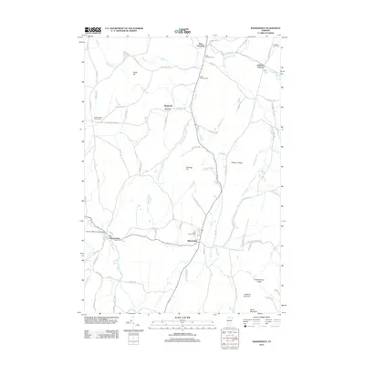
2012 Map of Bakersfield
USGS Topo · Published 2012About this map
East Fairfield and the surrounding Franklin County hills define this landscape, where the East Fairfield Covered Bridge spans the local waters near the settlement. The map documents a rural network of small communities and family landmarks, including Bordoville and West Enosburg, connected by winding roads such as Boston Post Rd and Chester Arthur Rd. High points like Leach Hill, Shattuck Mountain, and the distinct Checkerberry Ledge overlook a terrain carved by The Br and Beaver Meadow Brook. For local historians, the sheet is particularly valuable for its detailed indexing of burial grounds, from the North Fairfield Herrick Cem to the Enosburg Center Cem. Industrial heritage is noted at Gilberts Tannery, while the spiritual life of the area is reflected at the Bordoville Advent Cem and Saint Georges Cem.
Find a feature on this map
89 named features on this map. Tap any name to fly to it.
Don’t see what you’re looking for? This feature index may not catch every label — zoom into the map to look around manually.
Map Details
Editions of this 2012 Bakersfield Map
This is the sole edition of this map. No revisions or reprints were ever made.
Other maps of this area

1919 · Montgomery
USGS Topo · 1:62,500

1920 · Franklin Pond
USGS Topo · 1:62,500

1920 · Montgomery
USGS Topo · 1:62,500

1922 · Enosburg Falls
USGS Topo · 1:48,000

1924 · Enosburg Falls
USGS Topo · 1:62,500

1925 · Jay Peak
USGS Topo · 1:62,500

1925 · Mount Mansfield
USGS Topo · 1:48,000

1927 · Mount Mansfield
USGS Topo · 1:62,500

1927 · Hyde Park
USGS Topo · 1:48,000

1930 · Hyde Park
USGS Topo · 1:62,500