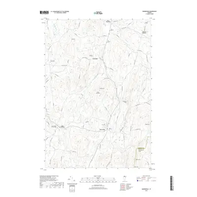
2018 Map of Bakersfield
USGS Topo · Published 2018About this map
The village of Bakersfield and the surrounding township of Sheldon are defined by a network of small settlements and mountain ridges. The terrain transitions from the elevations of Peaked Mtn and Burnt Mtn down to the fertile valleys shaped by The Br and Black Creek. These waterways were once the engines of local industry, evidenced by the location of Gilberts Tannery and the preservation of the East Fairfield Covered Bridge.
Find a feature on this map
76 named features on this map. Tap any name to fly to it.
Don’t see what you’re looking for? This feature index may not catch every label — zoom into the map to look around manually.
Map Details
Editions of this 2018 Bakersfield Map
This is the sole edition of this map. No revisions or reprints were ever made.
Other maps of this area

1919 · Montgomery
USGS Topo · 1:62,500

1920 · Franklin Pond
USGS Topo · 1:62,500

1920 · Montgomery
USGS Topo · 1:62,500

1922 · Enosburg Falls
USGS Topo · 1:48,000

1924 · Enosburg Falls
USGS Topo · 1:62,500

1925 · Jay Peak
USGS Topo · 1:62,500

1925 · Mount Mansfield
USGS Topo · 1:48,000

1927 · Mount Mansfield
USGS Topo · 1:62,500

1927 · Hyde Park
USGS Topo · 1:48,000

1930 · Hyde Park
USGS Topo · 1:62,500