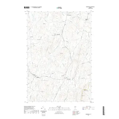
2021 Map of Bakersfield
USGS Topo · Published 2021About this map
Bakersfield and East Fairfield anchor this pocket of Northern Vermont, where the landscape transitions from the valley floors of Black Creek to the rising elevations of the Green Mountains. A distinct network of hilltop farms and rural crossroads is evident through several cemeteries, including the Bordoville Advent Cem and the North Fairfield - Herrick Cem, which preserve the genealogy of the area's early settlers. The terrain is defined by prominent high points such as Shattuck Mtn and Peaked Mtn, while the East Fairfield Covered Bridge serves as a notable architectural landmark crossing the water. This 2021 survey illustrates how modern road networks like Boston Post Rd and Fairfield Rd continue to follow the historical contours of the land, connecting scattered hamlets like West Enosburg and Bordoville.
Find a feature on this map
79 named features on this map. Tap any name to fly to it.
Don’t see what you’re looking for? This feature index may not catch every label — zoom into the map to look around manually.
Map Details
Editions of this 2021 Bakersfield Map
This is the sole edition of this map. No revisions or reprints were ever made.
Other maps of this area

1919 · Montgomery
USGS Topo · 1:62,500

1920 · Franklin Pond
USGS Topo · 1:62,500

1920 · Montgomery
USGS Topo · 1:62,500

1922 · Enosburg Falls
USGS Topo · 1:48,000

1924 · Enosburg Falls
USGS Topo · 1:62,500

1925 · Jay Peak
USGS Topo · 1:62,500

1925 · Mount Mansfield
USGS Topo · 1:48,000

1927 · Mount Mansfield
USGS Topo · 1:62,500

1927 · Hyde Park
USGS Topo · 1:48,000

1930 · Hyde Park
USGS Topo · 1:62,500