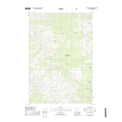
2020 Map of Bald Top Mountain
USGS Topo · Published 2020About this map
Bitterroot National Forest encompasses the high country of Ravalli County in this recent survey, defined by the prominent Sleeping Child Divide and various meadow complexes. The terrain is marked by significant elevations like Bald Top Mtn and Bald Top, while drainage systems such as Sleeping Child Creek and Two Bear Creek flow through the interior. Remote camps and specific geographical landmarks like White Stallion Camp and Crystal Point indicate the localized use of these mountains for recreation and forest management. The presence of Gods Little Acre Meadows and Barnett Meadows highlights the open mountain clearings that dot the landscape. Transport in this modern era is restricted to essential routes like the Skalkaho Rye Road and the Snow Trail 75 (Snow), reflecting the preservation of the area's wilderness character.
Find a feature on this map
36 named features on this map. Tap any name to fly to it.
Don’t see what you’re looking for? This feature index may not catch every label — zoom into the map to look around manually.
Map Details
Editions of this 2020 Bald Top Mountain Map
This is the sole edition of this map. No revisions or reprints were ever made.
Other maps of this area

1901 · Hamilton
USGS Topo · 1:125,000

1909 · Sapphire
USGS Topo · 1:125,000

1947 · Butte
USGS Topo · 1:250,000

1955 · Dillon
USGS Topo · 1:250,000

1956 · Elk City
USGS Topo · 1:250,000

1956 · Hamilton
USGS Topo · 1:250,000

1957 · Dillon
USGS Topo · 1:250,000

1958 · Butte
USGS Topo · 1:250,000

1958 · Dillon
USGS Topo · 1:250,000

1959 · Hamilton
USGS Topo · 1:250,000