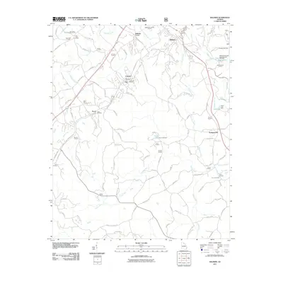
2011 Map of Baldwin
USGS Topo · Published 2011About this map
Baldwin and Alto sit along the corridor of the Norfolk Southern railroad, marking a landscape defined by small communities and an extensive network of family cemeteries. The terrain is characterized by the headwaters of several drainages, including Mud Creek, Little Mud Creek, and the Hudson River, which flows through the southern portion of the sheet. Numerous small impoundments like Wise Lake and Wynn Lake are scattered throughout the countryside, often associated with local landmarks such as Acreys Bridge. For genealogists, the map is particularly dense with burial sites including the Shirley Cemetery, B C Grant Cemetery, and The Line Cemetery. Settlement patterns are concentrated near Wilbanks Corner and Longview, while the Habersham County Airport occupies the northern plateau. The southern reaches near Wilson Shoals show a more rural, river-focused geography away from the primary rail and highway routes.
Find a feature on this map
119 named features on this map. Tap any name to fly to it.
Don’t see what you’re looking for? This feature index may not catch every label — zoom into the map to look around manually.
Map Details
Editions of this 2011 Baldwin Map
This is the sole edition of this map. No revisions or reprints were ever made.
Other maps of this area

1886 · Dahlonega
USGS Topo · 1:125,000

1886 · Walhalla
USGS Topo · 1:125,000

1891 · Gainesville
USGS Topo · 1:125,000

1891 · Carnesville
USGS Topo · 1:125,000

1892 · Dahlonega
USGS Topo · 1:125,000

1892 · Walhalla
USGS Topo · 1:125,000

1896 · Walhalla
USGS Topo · 1:125,000

1896 · Dahlonega
USGS Topo · 1:125,000

1903 · Dahlonega
USGS Topo · 1:125,000

1954 · Greenville
USGS Topo · 1:250,000