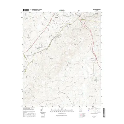
2014 Map of Baldwin
USGS Topo · Published 2014About this map
Baldwin and Cornelia anchor this 2014 survey of the upper Piedmont, where the Norfolk Southern rail line follows the ridgeline dividing the Hudson River and Little Mud Cr watersheds. This modern topographic record reveals the complex boundary lines where Habersham, Banks, and Hall counties converge near the unincorporated settlements of Raoul and Alto. The landscape is dotted with small family and community burial grounds, including the Crossroads Cem, Shirley Cem, and Wade Cem, providing essential data for genealogical research in this corridor. The northeastern portion of the map transitions into the Chattahoochee National Forest, featuring the heights of Chenocetah Mtn and the waters of Reservoir Two, illustrating the proximity of these north Georgia mountain communities to protected federal lands.
Find a feature on this map
170 named features on this map. Tap any name to fly to it.
Don’t see what you’re looking for? This feature index may not catch every label — zoom into the map to look around manually.
Map Details
Editions of this 2014 Baldwin Map
This is the sole edition of this map. No revisions or reprints were ever made.
Other maps of this area

1886 · Dahlonega
USGS Topo · 1:125,000

1886 · Walhalla
USGS Topo · 1:125,000

1891 · Gainesville
USGS Topo · 1:125,000

1891 · Carnesville
USGS Topo · 1:125,000

1892 · Dahlonega
USGS Topo · 1:125,000

1892 · Walhalla
USGS Topo · 1:125,000

1896 · Walhalla
USGS Topo · 1:125,000

1896 · Dahlonega
USGS Topo · 1:125,000

1903 · Dahlonega
USGS Topo · 1:125,000

1954 · Greenville
USGS Topo · 1:250,000