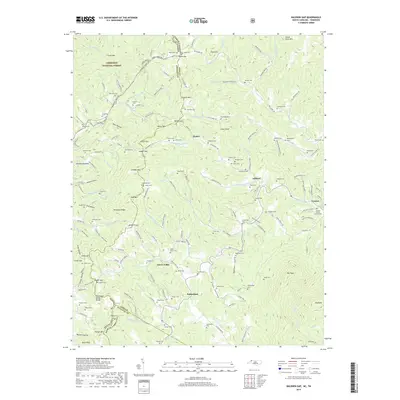
2019 Map of Baldwin Gap
USGS Topo · Published 2019About this map
The Tennessee Valley Divide snakes through this high-elevation landscape on the border of North Carolina and Tennessee, marking the hydrological split between the Atlantic and Gulf watersheds. Small agricultural and timber-based communities like Ashland, Green Valley, and Sutherland sit within the drainage of the N Fork New River, which flows through the eastern half of the map. The terrain is defined by prominent peaks including Pond Mtn and Willen Mtn, separated by high passes such as Baldwin Gap and Willen Gap. To the northwest, the map captures a portion of the Cherokee National Forest, illustrating the transition from managed public timberlands to the private homesteads and valleys of Ashe County. Local geography is intricately detailed with family-named hollows and branches, such as Dunn Hollow and McEwen Br, reflecting the deeply rooted settlement patterns of the Appalachian highlands.
Find a feature on this map
144 named features on this map. Tap any name to fly to it.
Don’t see what you’re looking for? This feature index may not catch every label — zoom into the map to look around manually.
Map Details
Editions of this 2019 Baldwin Gap Map
This is the sole edition of this map. No revisions or reprints were ever made.
Other maps of this area

1891 · Abingdon
USGS Topo · 1:125,000

1893 · Cranberry
USGS Topo · 1:125,000

1894 · Abingdon
USGS Topo · 1:125,000

1895 · Cranberry
USGS Topo · 1:125,000

1899 · Cranberry
USGS Topo · 1:125,000

1902 · Cranberry
USGS Topo · 1:125,000

1909 · Abingdon
USGS Topo · 1:96,000

1911 · Abingdon
USGS Topo · 1:125,000

1935 · Grayson
USGS Topo · 1:24,000

1935 · Park
USGS Topo · 1:24,000