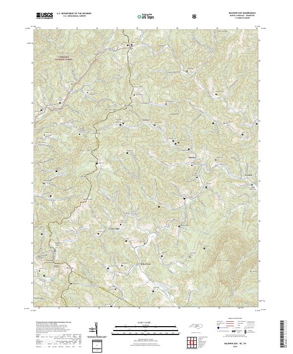
2022 Map of Baldwin Gap
USGS Topo · Published 2022About this map
Cherokee National Forest anchors the northwestern corner of this landscape, where the rugged peaks of the Appalachian high country define the border between Tennessee and North Carolina. The Tennessee-Valley Divide traverses the southern half of the sheet, separating the waters of the N Fork New River from the drainage basins that flow west toward the Mississippi. This area is characterized by high-elevation settlements like Green Valley and Ashland, which are connected by a network of winding mountain roads such as Cabbage Creek Rd and State Rd 1304.
Find a feature on this map
166 named features on this map. Tap any name to fly to it.
Don’t see what you’re looking for? This feature index may not catch every label — zoom into the map to look around manually.
Map Details
Editions of this 2022 Baldwin Gap Map
This is the sole edition of this map. No revisions or reprints were ever made.
Other maps of this area

1891 · Abingdon
USGS Topo · 1:125,000

1893 · Cranberry
USGS Topo · 1:125,000

1894 · Abingdon
USGS Topo · 1:125,000

1895 · Cranberry
USGS Topo · 1:125,000

1899 · Cranberry
USGS Topo · 1:125,000

1902 · Cranberry
USGS Topo · 1:125,000

1909 · Abingdon
USGS Topo · 1:96,000

1911 · Abingdon
USGS Topo · 1:125,000

1935 · Grayson
USGS Topo · 1:24,000

1935 · Park
USGS Topo · 1:24,000