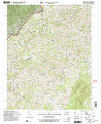
2003 Map of Baldwin Gap
USGS Topo · Published 2004About this map
Stone Mountain and Forge Mountain dominate this borderland landscape where Ashe Co and Watauga Co meet the Tennessee state line. The terrain is defined by narrow creek valleys and high ridges, where small communities like Creston and Sutherland developed along the North Fork New River. The map reveals a high density of family-named cemeteries and rural churches, such as Rock Creek Methodist Ch and Hamilton Chapel, which anchor the scattered homesteads connected by winding mountain roads.
Find a feature on this map
103 named features on this map. Tap any name to fly to it.
Don’t see what you’re looking for? This feature index may not catch every label — zoom into the map to look around manually.
Map Details
Editions of this 2003 Baldwin Gap Map
This is the sole edition of this map. No revisions or reprints were ever made.
Other maps of this area

1891 · Abingdon
USGS Topo · 1:125,000

1893 · Cranberry
USGS Topo · 1:125,000

1894 · Abingdon
USGS Topo · 1:125,000

1895 · Cranberry
USGS Topo · 1:125,000

1899 · Cranberry
USGS Topo · 1:125,000

1902 · Cranberry
USGS Topo · 1:125,000

1909 · Abingdon
USGS Topo · 1:96,000

1911 · Abingdon
USGS Topo · 1:125,000

1935 · Grayson
USGS Topo · 1:24,000

1935 · Park
USGS Topo · 1:24,000