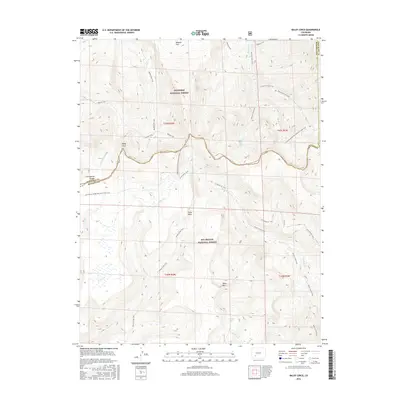
2016 Map of Baldy Cinco
USGS Topo · Published 2016About this map
Baldy Cinco rises as a central peak along the rugged ridge of the Continental Divide, where the high-altitude terrain of the San Juan Mountains creates a natural boundary between several Colorado counties. This survey illustrates the intricate drainage patterns of the high country, with Rough Cr and the E Fork Cebolla Cr flowing north toward the Gunnison National Forest, while the southern slopes feed Willow Cr and Miner's Cr within the Rio Grande National Forest. The expansive Snow Mesa dominates the central portion of the map, a distinctive flat-topped feature that serves as a landmark for those traversing the Continental Divide National Scenic Trail. Traces of the region's mining history are evident at Mineral Park, while recreational routes like the Skyline Trail and Willow Creek Trail follow traditional paths through this wilderness.
Find a feature on this map
34 named features on this map. Tap any name to fly to it.
Don’t see what you’re looking for? This feature index may not catch every label — zoom into the map to look around manually.
Map Details
Editions of this 2016 Baldy Cinco Map
This is the sole edition of this map. No revisions or reprints were ever made.
Other maps of this area

1905 · San Cristobal
USGS Topo · 1:125,000

1907 · San Cristobal
USGS Topo · 1:125,000

1908 · Uncompahgre
USGS Topo · 1:125,000

1911 · Uncompahgre
USGS Topo · 1:125,000

1914 · Creede
USGS Topo · 1:125,000

1916 · Creede
USGS Topo · 1:125,000

1945 · Durango
USGS Topo · 1:250,000

1953 · Durango
USGS Topo · 1:250,000

1954 · Durango
USGS Topo · 1:250,000

1956 · Montrose
USGS Topo · 1:250,000