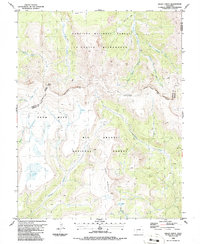
1986 Map of Baldy Cinco
USGS Topo · Published 1986About this map
The Continental Divide snake-like path through the high country of Colorado defines this 1980s landscape, separating the headwaters of the Gunnison National Forest and Rio Grande National Forest. The map centers on the high-altitude expanse of Snow Mesa, a distinct plateau-like feature north of Miners Creek. At an elevation exceeding 13,000 feet, Baldy Cinco stands as a prominent landmark on the wilderness boundary. The presence of Prospects on the eastern edge of the survey near Mineral Creek suggests localized mineral exploration, while an intricate network of pack trails, including the Cebolla Trail and the Skyline Trail, indicates a landscape primarily accessible by foot or horse. These routes connect points like Mineral Park and Crystal Lake, highlighting the traditional transportation patterns of the La Garita Wilderness before modern road development touched these high peaks.
Find a feature on this map
28 named features on this map. Tap any name to fly to it.
Don’t see what you’re looking for? This feature index may not catch every label — zoom into the map to look around manually.
Map Details
Editions of this 1986 Baldy Cinco Map
This is the sole edition of this map. No revisions or reprints were ever made.
Other maps of this area

1905 · San Cristobal
USGS Topo · 1:125,000

1907 · San Cristobal
USGS Topo · 1:125,000

1908 · Uncompahgre
USGS Topo · 1:125,000

1911 · Uncompahgre
USGS Topo · 1:125,000

1914 · Creede
USGS Topo · 1:125,000

1916 · Creede
USGS Topo · 1:125,000

1945 · Durango
USGS Topo · 1:250,000

1953 · Durango
USGS Topo · 1:250,000

1954 · Durango
USGS Topo · 1:250,000

1956 · Montrose
USGS Topo · 1:250,000