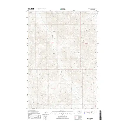
2017 Map of Baldy Peak
USGS Topo · Published 2017About this map
Baldy Peak stands as the primary landmark in this corner of Powder River County, where the high plains of southeast Montana are carved into a series of deep drainages. The landscape is defined by its seasonal waterways, including Butte Cr and the descriptively named Baking Powder Cr, which flow through an area marked by numerous named draws. These features, such as Allison Draw, Marvin Draw, and Tracks Draw, reflect a long history of local land use and geographic orientation in an area where vertical relief is provided by formations like Terrett Butte.
Find a feature on this map
19 named features on this map. Tap any name to fly to it.
Don’t see what you’re looking for? This feature index may not catch every label — zoom into the map to look around manually.
Map Details
Editions of this 2017 Baldy Peak Map
This is the sole edition of this map. No revisions or reprints were ever made.
Other maps of this area

1954 · Ekalaka
USGS Topo · 1:250,000

1956 · Ekalaka
USGS Topo · 1:250,000

1958 · Ekalaka
USGS Topo · 1:250,000

1965 · Ekalaka
USGS Topo · 1:250,000

1970 · Wild Bill Creek
USGS Topo · 1:24,000

1970 · Baldy Peak
USGS Topo · 1:24,000

1970 · Huckins School
USGS Topo · 1:24,000
1970 · Bay Horse
USGS Topo · 1:24,000

1970 · Bear Skull Mountain
USGS Topo · 1:24,000
1970 · Three Bar Ranch
USGS Topo · 1:24,000