Old Maps of Powder River County, Montana
Explore 550 old maps of Powder River County, spanning from 1954 to today. These high-resolution historic maps reveal how streets, neighborhoods, landmarks, and natural features evolved over time — perfect for genealogy, metal detecting, research, and local history exploration.
What you can do with these maps:
- See how Powder River County changed over time: Compare historical maps to modern-day views to trace roads, homesites, rail lines & more.
- View detailed metadata: Each map includes creators, publishers, year, scale, and archive source.
- Overlay maps with satellite & LiDAR: Visualize the past alongside modern tools to explore terrain & human change.
- Trusted historical sources: Maps sourced from the USGS, Library of Congress, and other archives.
- Access maps your way: View online, download high-res files, or order prints for personal or research use.
Start exploring old maps of Powder River County to uncover forgotten places, hidden landmarks, and the deep history beneath your feet.
Powder River County, MT maps
(550)- 1954 Map of Hardin, 1964 Print
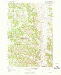
 1954 Hardin1964 Print · USGSSoutheastern Montana is documented here during the mid-fifties, showing the vast tribal lands and historic battle sites before modern highway expansion. Researchers can trace the Chicago Burlington and Quincy rail line through Hardin or locate the Custer National Cemetery and Museum.2 unique versions available
 - 1954 Map of Ekalaka, 1966 Print
 1954 Ekalaka1966 Print · USGSSoutheastern Montana and its borderlands with the Dakotas and Wyoming appear here in the mid-fifties, showing a remote ranching landscape. Genealogists can trace family roots through numerous rural landmarks like the Sherwin School, St Marys Ch, and Powderville.3 unique versions available
 - 1954 Map of Gillette, 1975 Print
 1954 Gillette1975 Print · USGSGillette and the northeast Wyoming ranching country are captured here in the mid-1950s as coal and bentonite mining shaped the local economy. Genealogists can trace family landmarks like the Bethlehem Church, Wellman School, and early settlements along the Chicago Burlington and Quincy RR.
 - 1955 Map of Sheridan, 1973 Print
 1955 Sheridan1973 Print · USGSThe Bighorn Mountains meet the Powder River Basin in the 1950s, a period when cattle ranching and coal mining defined the regional economy. Genealogists and historians can trace local landmarks like the Fort Mackenzie Veteran Hospital, the Monarch Coal Mine, and legacy operations such as the Beckton Stock Farm.2 unique versions available
 - 1955 Map of Gillette, 1976 Print
 1955 Gillette1976 Print · USGSNortheastern Wyoming in the mid-twentieth century is captured here as the energy and ranching landscape began to shift. Genealogists and historians can trace the foundations of local communities through sites like Wyodak, the Pleasantdale Community Building, and landmarks like Devils Tower National Monument.
 - 1956 Map of Ekalaka
 1956 Ekalaka1956 Print · USGSSoutheast Montana and the Wyoming borderlands are shown here in the mid-fifties, capturing a landscape of remote ranching outposts and isolated country schools. Genealogists can trace family roots through landmarks like Boyes, Alzada, and Peabody School.
 - 1957 Map of Hardin
 1957 Hardin1957 Print · USGSSoutheastern Montana in the mid-fifties reveals a landscape shaped by tribal lands and the historic Bighorn river valleys. Researchers can trace the Chicago Burlington and Quincy RR through Hardin and locate the National Cemetery and Custer Battlefield Monument.
 - 1958 Map of Gillette
 1958 Gillette1958 Print · USGSNortheastern Wyoming and the Black Hills are captured here in the late fifties, showcasing a landscape of high-plains ranching and emerging energy production. Researchers can trace the rail-side growth of Gillette and find historic rural landmarks like the Wyodak Coal Mine, Bethlehem Church, and Devils Tower National Monument.2 unique versions available
 - 1958 Map of Ekalaka
 1958 Ekalaka1958 Print · USGSSoutheast Montana in the mid-fifties remains a landscape of isolated ranching outposts and scattered schoolhouses. Genealogists and researchers can trace rural life through landmarks like Belltower, the McClary Ranger Station, and numerous family-named schools such as Davidson School.
 - 1958 Map of Hardin
 1958 Hardin1958 Print · USGSSoutheastern Montana in the mid-fifties presents a landscape defined by significant tribal lands and national monuments. Researchers can trace the geography of the Little Bighorn at Custer Battlefield National Monument and locate settlements like Lame Deer and Birney.
 - 1958 Map of Sheridan
 1958 Sheridan1958 Print · USGSThe Bighorn Mountains meet the high plains in the mid-1950s, revealing a landscape of large-scale ranching and mineral extraction. Trace the legacy of early settlements and industry through the Kleenburn Coal Tipple, Beckton Stock Farm, and the Hidden Dome Oil & Gas Field.2 unique versions available
 - 1962 Map of Gillette
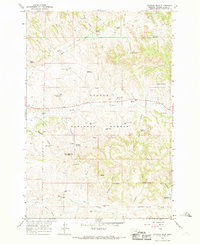
 1962 Gillette1962 Print · USGSHigh plains ranching and coal mining dominate the Powder River Basin in the early sixties. Genealogists can trace rural communities through landmarks like the Bethlehem Church, Lake School, and settlements such as Moorcroft and Sundance.
 - 1962 Map of Sheridan
 1962 Sheridan1962 Print · USGSThe Big Horn Mountains and Powder River country are captured here in the early sixties as energy production and ranching shaped northern Wyoming. Researchers can locate specific sites like the Kleenburn Coal Tipple, Eaton Bros Ranch, and the Fort McKenzie Veteran Hospital.
 - 1965 Map of Ekalaka
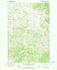
 1965 Ekalaka1965 Print · USGSThe High Plains of Montana and Wyoming appear here in the mid-1950s, as a sprawling landscape of remote ranchlands and rural school districts. Researchers can trace the locations of many small landmarks like Mitchell School, Broadus, and the Humbolt Hills.
 - 1966 Map of Goodspeed Butte, 1969 Print
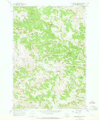
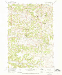
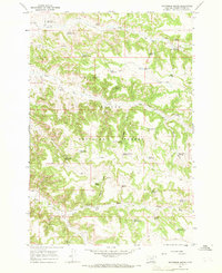 1966 Goodspeed Butte1969 Print · USGSPowder River County in the mid-1960s shows a landscape of remote cattle ranching and timber activity within the Custer National Forest. Researchers can trace old water sources and industrial sites like Elk Creek Sawmill Spring, Goodspeed Butte, and Howes Reservoir.2 unique versions available
 - 1966 Map of Sonnette, 1969 Print
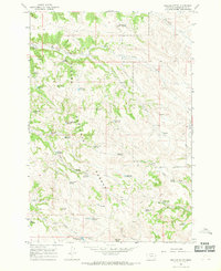
 1966 Sonnette1969 Print · USGSThe ranching community of Sonnette and its surrounding drainages appear here during the mid-sixties. Researchers can locate the Mitchell Sch, the workings at Two Tree Mine, and the headwaters of Pumpkin Creek.2 unique versions available
 - 1966 Map of Coleman Draw, 1969 Print
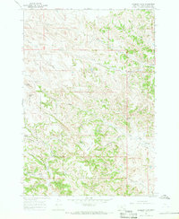
 1966 Coleman Draw1969 Print · USGSPowder River County in the late sixties shows a landscape of remote cattle ranching and early coal extraction. Researchers can trace rural water rights through the Gaskill Reservoir and Coal Bank Spring, or locate the Home Creek Sch.2 unique versions available
 - 1966 Map of Stacey, 1969 Print
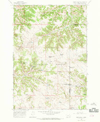
 1966 Stacey1969 Print · USGSPowder River County is shown here in the 1960s, documenting a landscape of federal forest lands and small-scale ranching. Genealogists can trace the rural community near Stacey, while researchers can locate the South Stacey Sch and the Whitetail Ranger Sta.2 unique versions available
 - 1966 Map of Home Creek Butte, 1969 Print
 1966 Home Creek Butte1969 Print · USGSPowder River County ranchlands and forest are captured here in the mid-1960s, showing a remote landscape shaped by water rights and rugged terrain. Researchers can trace historic landmarks like the Schoolhouse, Home Creek Butte, and named water sources like Lemonade Spring.2 unique versions available
 - 1966 Map of Phillips Butte, 1969 Print
 1966 Phillips Butte1969 Print · USGSPowder River County ranchlands are captured here in the mid-1960s, showing the intricate water systems of the Custer National Forest. Researchers can trace old livestock routes and range improvements through sites like Phillips Butte, Coal Mine Spring, and the North Fork Taylor Creek Well.2 unique versions available
 - 1966 Map of Hodsdon Flats, 1969 Print
 1966 Hodsdon Flats1969 Print · USGSPowder River County ranchlands are captured here in the mid-1960s, showing the intersection of Custer National Forest and the Hodsdon Flats. Researchers can trace old fence lines and ranch water sources like Callaway Reservoir, Mason Spring, and Turtle Reservoir.2 unique versions available
 - 1966 Map of Poker Jim Butte, 1969 Print
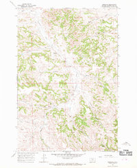
 1966 Poker Jim Butte1969 Print · USGSSoutheastern Montana's high rangelands and timbered draws are captured here in the mid-1960s as they straddle the Rosebud and Powder River county line. Researchers can trace land use through a network of remote water sources like Parrish Spring and the Experimental Pasture Reservoir near Poker Jim Butte.2 unique versions available
 - 1966 Map of Fort Howes, 1969 Print
 1966 Fort Howes1969 Print · USGSRanching life in the Montana backcountry comes into focus during the late sixties as this survey tracks the water sources and schoolhouses of the high plains. Genealogists and historians can locate the Fort Howes (Historical Site), the Otter Creek Sch, and family-named landmarks like Lyon Creek Well.3 unique versions available
 - 1966 Map of Beaver Creek School, 1969 Print
 1966 Beaver Creek School1969 Print · USGSPowder River County ranchlands are documented here in the mid-sixties as the region balanced forestry and livestock. Researchers can find the remote Beaver Creek School, family-named landmarks like Sartin Draw, and an isolated pioneer Grave.3 unique versions available
 - 1966 Map of Threemile Buttes, 1969 Print
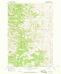
 1966 Threemile Buttes1969 Print · USGSPowder River County ranchlands and national forest territory are captured here in the mid-1960s. Researchers can locate remote high-plains landmarks like the Sterling Mine, Bowers Reservoir, and numerous named water sources including Old Faithful Spring.2 unique versions available
Showing maps 1-25 of 550
Top cities of Powder River County
Frequently asked questions
- What are the different types of historical maps available for Powder River County?
- What is the oldest map of Powder River County?
- Where can I purchase historical maps of Powder River County for my home or office?
- Where can I download high-res historical maps of Powder River County?
- Are there historical topographic maps available for Powder River County?
- Is there historical aerial imagery available for Powder River County?
- Where are historical maps of Powder River County sourced from?