
1954 Map of Hardin
USGS Topo · Published 1964About this map
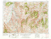
The Custer Battlefield National Monument and Reno Benteen Battlefield Monument serve as central historical landmarks on this mid-century survey of southeastern Montana. The landscape is defined by the expansive Crow Indian Reservation and the Northern Cheyenne Indian Reservation, where settlements like Lame Deer and Lodge Grass anchor the tribal lands. Water management and transport are key features of the era, highlighted by the Tongue River Irrigation Reservoir and the Chicago Burlington and Quincy railroad line following the path of the Little Bighorn River. From the heights of the Wolf Mountains to the valleys of Rosebud Creek, the map details a region where ranching, agriculture, and tribal history converge. Smaller settlements such as Quietus, Kirby, and Decker are shown alongside the extensive Custer National Forest, illustrating the remote nature of the Tongue River and Powder River country before modern interstate development fully transformed the region.
Find a feature on this map
57 named features on this map. Tap any name to fly to it.
Don’t see what you’re looking for? This feature index may not catch every label — zoom into the map to look around manually.
Map Details
Editions of this 1954 Hardin Map
2 editions found
Other maps of this area

1893 · Huntley
USGS Topo · 1:125,000

1894 · Rosebud
USGS Topo · 1:125,000

1894 · St. Xavier
USGS Topo · 1:125,000

1894 · Fort Custer
USGS Topo · 1:125,000

1895 · Dayton
USGS Topo · 1:125,000

1898 · Bald Mountain
USGS Topo · 1:125,000

1901 · Rosebud
USGS Topo · 1:125,000

1901 · Dayton
USGS Topo · 1:125,000

1901 · St. Xavier
USGS Topo · 1:125,000

1901 · Bald Mountain
USGS Topo · 1:125,000