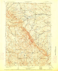
1901 Map of Dayton
USGS Topo · Published 1901About this map
The Burlington and Missouri River R. R. cuts across the northern landscape of this 1901 survey, following the valley of the Tongue River near the burgeoning settlements of Dayton and Ranchester. This era represents a period of significant transition as the Bighorn Forest Reserve was established to manage the timber and water resources of the high country. The map documents the early infrastructure of the region, from the Coal Mine workings near the Montana border to the network of isolated outposts like the Tongue River Cabin and Rockwood. These mountain outposts and valley ranches, such as the Morrow Ranch, illustrate the precarious balance between the nascent industrial extraction of coal and the established livestock operations of the eastern Bighorn slopes. Geological landmarks like Steamboat Pt. and Elephant Foot provide orientation for those navigating the steep drainages of Wolf Creek and Little Tongue River.
Find a feature on this map
70 named features on this map. Tap any name to fly to it.
Don’t see what you’re looking for? This feature index may not catch every label — zoom into the map to look around manually.
Map Details
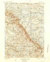
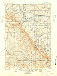
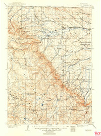
Editions of this 1901 Dayton Map
5 editions found