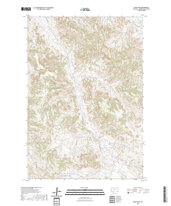
2024 Map of Baldy Peak
USGS Topo · Published 2024About this map
The drainage basins of Powder River County are defined by a complex network of seasonal watercourses and draws. Baldy Peak stands as the central high point of this landscape, surrounded by the headwaters of Butte Creek and its significant tributary, East Fork Butte Creek. The terrain is deeply incised by numerous named draws, including Tracks Draw and Marvin Draw, which historically influenced the movement of livestock and early settlers through these high plains. Transport is marked by the winding routes of Butte Creek Rd and Baldy Peak Rd, following the natural contours of the land. Other evocative local landmarks include Baking Powder Creek, Buttermilk Creek, and Coal Bank Creek, names that suggest the practical and geographic concerns of the area's early inhabitants and surveyors.
Find a feature on this map
20 named features on this map. Tap any name to fly to it.
Don’t see what you’re looking for? This feature index may not catch every label — zoom into the map to look around manually.
Map Details
Editions of this 2024 Baldy Peak Map
This is the sole edition of this map. No revisions or reprints were ever made.
Other maps of this area

1954 · Ekalaka
USGS Topo · 1:250,000

1956 · Ekalaka
USGS Topo · 1:250,000

1958 · Ekalaka
USGS Topo · 1:250,000

1965 · Ekalaka
USGS Topo · 1:250,000

1970 · Wild Bill Creek
USGS Topo · 1:24,000

1970 · Baldy Peak
USGS Topo · 1:24,000

1970 · Huckins School
USGS Topo · 1:24,000
1970 · Bay Horse
USGS Topo · 1:24,000

1970 · Bear Skull Mountain
USGS Topo · 1:24,000
1970 · Three Bar Ranch
USGS Topo · 1:24,000