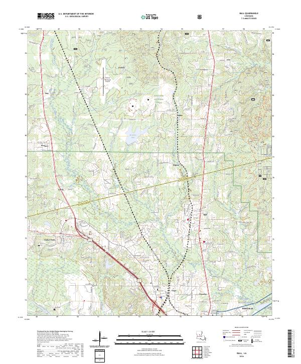
2024 Map of Ball
USGS Topo · Published 2024About this map
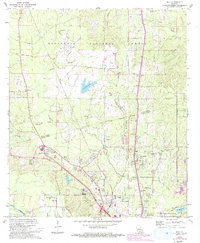
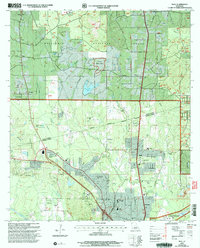
The boundary between Grant Parish and Rapides Parish bisects this landscape, which transitions from the forested uplands of the Kisatchie National Forest toward the developing corridors north of the Red River. Central to this map is the town of Ball, situated along a transit artery that connects northern settlements like Pollock and Simms to the southern hub of Pineville. The region is defined by a dense network of local roads and loops, including Joiners Loop and Ferguson Loop, reflecting the area’s residential growth and rural road systems. Natural drainage is shaped by Flagon Bayou and Kitchen Creek, which carve through the terrain near Kisatchie Lake. To the south, the map details established community sites such as Tioga and Paradise, along with the Forest Lawn Memorial Park and Mausoleum, providing a clear view of the area's civil and topographic layout at the time of the survey.
Find a feature on this map
88 named features on this map. Tap any name to fly to it.
Don’t see what you’re looking for? This feature index may not catch every label — zoom into the map to look around manually.
Map Details
Editions of this 2024 Ball Map
This is the sole edition of this map. No revisions or reprints were ever made.