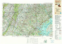
1989 Map of Baltimore
USGS Topo · Published 1989About this map
The Chesapeake Bay and the upper reaches of the Potomac River anchor this late-twentieth-century study of the Mid-Atlantic corridor. Reaching from the industrial waterfronts of Baltimore and Dundalk to the eastern slopes of the Blue Ridge Mountains, the landscape reveals a dense network of suburban expansion and military installations. Significant federal lands like the Aberdeen Proving Ground and Fort George G. Meade occupy vast tracts near the coast, while the interior is defined by critical water management systems including Prettyboy Reservoir and Liberty Reservoir.
Find a feature on this map
110 named features on this map. Tap any name to fly to it.
Don’t see what you’re looking for? This feature index may not catch every label — zoom into the map to look around manually.
Map Details
Editions of this 1989 Baltimore Map
This is the sole edition of this map. No revisions or reprints were ever made.
Other maps of this area

1884 · Harpers Ferry
USGS Topo · 1:125,000

1890 · Mt. Vernon
USGS Topo · 1:125,000

1891 · Harpers Ferry
USGS Topo · 1:125,000

1891 · Mt. Vernon
USGS Topo · 1:125,000

1892 · Laurel
USGS Topo · 1:62,500

1892 · Ellicott
USGS Topo · 1:62,500

1892 · Owensville
USGS Topo · 1:62,500

1892 · Annapolis
USGS Topo · 1:62,500

1893 · North Point
USGS Topo · 1:62,500

1893 · Gunpowder
USGS Topo · 1:62,500