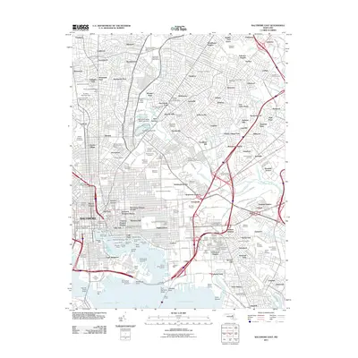
2011 Map of Baltimore East
USGS Topo · Published 2011About this map
Fort McHenry Angle stands at the entrance to the Northwest Harbor, anchoring a landscape where Baltimore’s maritime legacy meets modern urban infrastructure. This survey details the complex waterfront from Fells Point and Canton down to the massive industrial reaches of the Seagirt Marine Terminal and Locust Point Marine Terminal. The map captures the city's academic core, featuring the sprawling campuses of Johns Hopkins University, Loyola University Maryland, and Morgan State University. Beyond the piers, the inland residential pattern is defined by historic neighborhoods like Mount Vernon and Highlandtown, while extensive green spaces such as Greenmount Cemetery and Clifton Park and Golf Course provide a distinct contrast to the dense grid of rowhouse blocks and the heavy rail corridors of the Port Covington Yard.
Find a feature on this map
209 named features on this map. Tap any name to fly to it.
Don’t see what you’re looking for? This feature index may not catch every label — zoom into the map to look around manually.
Map Details
Editions of this 2011 Baltimore East Map
This is the sole edition of this map. No revisions or reprints were ever made.
Other maps of this area

1893 · North Point
USGS Topo · 1:62,500

1893 · Gunpowder
USGS Topo · 1:62,500

1894 · Baltimore
USGS Topo · 1:62,500

1894 · Relay
USGS Topo · 1:62,500

1898 · Tolchester
USGS Topo · 1:125,000

1899 · Baltimore
USGS Topo · 1:62,500

1901 · Gunpowder
USGS Topo · 1:62,500

1903 · Tolchester
USGS Topo · 1:125,000

1904 · Baltimore
USGS Topo · 1:62,500

1904 · North Point
USGS Topo · 1:62,500