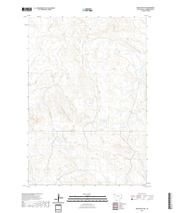
2021 Map of Bams Butte NW
USGS Topo · Published 2021About this map
J B Rd provides a primary east-west corridor across this segment of Harding County, South Dakota, where the High Plains landscape is defined by its intermittent drainage network. The terrain is etched by several seasonal watercourses, most notably Clarks Fork Cr in the northwest and Double X Cr winding through the eastern sections. These creeks, along with Goose Cr and Duck Cr, illustrate the subtle topographic variations that have historically influenced land use and travel in this sparsely populated region. The map captures the geometric regularity of the Public Land Survey System, showing several township divisions including t17n r5e and t18n r6e. This 2021 study reflects the continued character of the Great Plains, where long-established road names and drainage patterns remain the primary landmarks for local navigation and land management.
Find a feature on this map
11 named features on this map. Tap any name to fly to it.
Don’t see what you’re looking for? This feature index may not catch every label — zoom into the map to look around manually.
Map Details
Editions of this 2021 Bams Butte NW Map
This is the sole edition of this map. No revisions or reprints were ever made.
Other maps of this area

1935 · Reva
USGS Topo · 1:125,000

1935 · Hoover
USGS Topo · 1:125,000

1935 · Harding
USGS Topo · 1:125,000

1935 · Buffalo
USGS Topo · 1:125,000

1954 · Lemmon
USGS Topo · 1:250,000

1957 · Lemmon
USGS Topo · 1:250,000

1971 · Buffalo
USGS Topo · 1:24,000
1971 · Sheep Pen Draw SW
USGS Topo · 1:24,000
1971 · Sheep Pen Draw SE
USGS Topo · 1:24,000

1973 · Redig
USGS Topo · 1:24,000