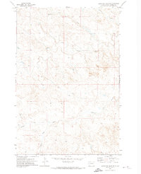
1971 Map of Sheep Pen Draw SW
USGS Topo · Published 1974About this map
Old Grand River Cem stands as a lonely marker of early settlement in this corner of Harding County, situated near the northern banks where Sheep Creek meets the broader drainage of the plains. This 1971 field-checked survey reveals a landscape defined by its complex hydrologic network, centered on the winding course of the South Fork Grand River. The terrain is characterized by an intricate web of seasonal watercourses and drainages including Boxelder Creek, Buffalo Creek, and Clarks Fork, which cut through the high prairie. The presence of isolated industrial sites, marked simply as Well, suggests the area's transition into modern resource exploration while maintaining its vast, open character. The map meticulously records the township and range lines of T. 19 N. and T. 18 N., providing a precise grid for genealogists and land researchers tracing family holdings in this rural frontier.
Find a feature on this map
8 named features on this map. Tap any name to fly to it.
Don’t see what you’re looking for? This feature index may not catch every label — zoom into the map to look around manually.
Map Details
Editions of this 1971 Sheep Pen Draw SW Map
This is the sole edition of this map. No revisions or reprints were ever made.
Other maps of this area

1935 · Reva
USGS Topo · 1:125,000

1935 · Hoover
USGS Topo · 1:125,000

1935 · Harding
USGS Topo · 1:125,000

1935 · Buffalo
USGS Topo · 1:125,000

1954 · Lemmon
USGS Topo · 1:250,000

1957 · Lemmon
USGS Topo · 1:250,000

1971 · Buffalo
USGS Topo · 1:24,000
1971 · Sheep Pen Draw
USGS Topo · 1:24,000

1971 · McKenzie Butte
USGS Topo · 1:24,000
1971 · Sheep Pen Draw SE
USGS Topo · 1:24,000