
1971 Map of McKenzie Butte
USGS Topo · Published 1974About this map
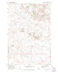
The South Cave Hills dominate this portion of the Custer National Forest in Harding County, showcasing a landscape of high buttes and named springs. Isolated landmarks such as McKenzie Butte, Penttila Butte, and Sheep Mountain define the topography, while water sources like John Brown Spring No. 1 and McKenzie Spring provided vital resources for early homesteading and ranching efforts.
Find a feature on this map
29 named features on this map. Tap any name to fly to it.
Don’t see what you’re looking for? This feature index may not catch every label — zoom into the map to look around manually.
Map Details
Editions of this 1971 McKenzie Butte Map
2 editions found
Other maps of this area

1935 · Reva
USGS Topo · 1:125,000

1935 · Buffalo
USGS Topo · 1:125,000

1954 · Lemmon
USGS Topo · 1:250,000

1957 · Lemmon
USGS Topo · 1:250,000

1968 · Ludlow
USGS Topo · 1:24,000

1969 · Ladner
USGS Topo · 1:24,000

1969 · Ladner SE
USGS Topo · 1:24,000

1971 · Buffalo
USGS Topo · 1:24,000
1971 · Lahti Butte
USGS Topo · 1:24,000
1971 · Sheep Pen Draw SW
USGS Topo · 1:24,000