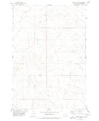
1978 Map of Bams Butte NW
USGS Topo · Published 1978About this map
Clarks Fork Creek and Goose Creek thread through this expansive stretch of the High Plains in Harding County, South Dakota. Mapping conducted in the late 1970s reveals a landscape defined by ranching and resource extraction, with features like a Drill Hole, a Well, and a Radio Tower punctuating the open terrain. The transportation network is sparse, centered on the J B Road, which serves as a primary artery across the sections of T 17 N and T 18 N. Small natural landmarks like the Bowl and a seasonal Spring suggest the importance of topography and water access in this semi-arid region. The map provides a precise record of section lines and township boundaries, essential for tracing land ownership and historical grazing tracts near West Squaw Creek and Duck Creek.
Find a feature on this map
13 named features on this map. Tap any name to fly to it.
Don’t see what you’re looking for? This feature index may not catch every label — zoom into the map to look around manually.
Map Details
Editions of this 1978 Bams Butte NW Map
This is the sole edition of this map. No revisions or reprints were ever made.
Other maps of this area

1935 · Reva
USGS Topo · 1:125,000

1935 · Hoover
USGS Topo · 1:125,000

1935 · Harding
USGS Topo · 1:125,000

1935 · Buffalo
USGS Topo · 1:125,000

1954 · Lemmon
USGS Topo · 1:250,000

1957 · Lemmon
USGS Topo · 1:250,000

1971 · Buffalo
USGS Topo · 1:24,000
1971 · Sheep Pen Draw SW
USGS Topo · 1:24,000
1971 · Sheep Pen Draw SE
USGS Topo · 1:24,000

1973 · Redig
USGS Topo · 1:24,000