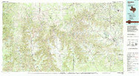
1985 Map of Bandera
USGS Topo · Published 1994About this map
Bandera Pass serves as a historic gateway through the limestone ridges of the Texas Hill Country, anchoring a landscape where the Frio River, Sabinal River, and Medina River carve deep valleys through the Edwards Plateau. This mid-1980s representation shows a transition in land use, from the traditional ranching around Utopia and Tarpley to the establishment of protected conservation lands. Significant recreational and natural areas are established here, including Lost Maples State Park and Garner State Park, protecting the unique canyons and bigtooth maple groves of the region. The road network, comprised of routes like Farm Road 337 and Texas 16, winds through an area marked by numerous named peaks such as Sugarloaf Mountain and Twin Sisters. Remote settlements like Vanderpool and Reagan Wells reflect the enduring rural character of this intersection of Bandera, Real, and Uvalde counties.
Find a feature on this map
106 named features on this map. Tap any name to fly to it.
Don’t see what you’re looking for? This feature index may not catch every label — zoom into the map to look around manually.
Map Details
Editions of this 1985 Bandera Map
2 editions found
Other maps of this area

1893 · Rock Springs
USGS Topo · 1:125,000

1893 · Nueces
USGS Topo · 1:125,000

1894 · Fredericksburg
USGS Topo · 1:125,000

1894 · Kerrville
USGS Topo · 1:125,000

1896 · Nueces
USGS Topo · 1:125,000

1896 · Brackett
USGS Topo · 1:125,000

1897 · Brackett
USGS Topo · 1:125,000

1898 · Uvalde
USGS Topo · 1:125,000

1899 · Uvalde
USGS Topo · 1:125,000

1938 · Turkey Mountain
USGS Topo · 1:48,000