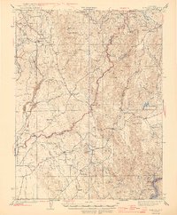
1944 Map of Bangor
USGS Topo · Published 1944About this map
Gold-bearing gravels and hard-rock quartz veins define the industrial landscape across this mid-century survey of the Butte and Yuba County border. Centered on the settlement of Bangor, the map documents a region still heavily influenced by its mining heritage, from the Blue Lead Mine to the Phoenix Mine (Abandoned) and the Manzanita Mine. The complex hydraulic and hard-rock history is evident in the network of ditches like the Wyandotte Canal and named topographical features such as Swedes Flat and New York Flat Cr.
Find a feature on this map
58 named features on this map. Tap any name to fly to it.
Don’t see what you’re looking for? This feature index may not catch every label — zoom into the map to look around manually.
Map Details
Editions of this 1944 Bangor Map
2 editions found

Other maps of this area

1888 · Marysville
USGS Topo · 1:125,000

1888 · Smartsville
USGS Topo · 1:125,000

1888 · Bidwell Bar
USGS Topo · 1:125,000

1891 · Bidwell Bar
USGS Topo · 1:125,000

1891 · Chico
USGS Topo · 1:125,000

1891 · Marysville
USGS Topo · 1:125,000

1891 · Smartsville
USGS Topo · 1:125,000

1892 · Smartsville
USGS Topo · 1:125,000

1893 · Chico
USGS Topo · 1:125,000

1893 · Bidwell Bar
USGS Topo · 1:125,000