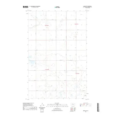
2020 Map of Bantry NW
USGS Topo · Published 2020About this map
The rolling plains of McHenry County are defined by a network of seasonal wetlands and prairie depressions in this recent survey. Drainage through the northwestern corner is dictated by Cut Bank Creek, which meanders across the section lines near Cut Bank Cr. The landscape is sparse, characterized by the traditional section-line grid of the Public Land Survey System, with gravel roads like 74th St N and 67th St N carving the territory into neat square miles. A localized point of historical interest is found at the Prairie Winds Cem in the southeastern quadrant, a quiet marker of the community's presence in this expansive agricultural region. Nearby, Goose Lake provides a significant hydrographic feature among the numerous small, unnamed ponds and wetlands that dot the prairie, while the Prairie Trl offers one of the few named traversals across the central township sections.
Find a feature on this map
17 named features on this map. Tap any name to fly to it.
Don’t see what you’re looking for? This feature index may not catch every label — zoom into the map to look around manually.
Map Details
Editions of this 2020 Bantry NW Map
This is the sole edition of this map. No revisions or reprints were ever made.
Other maps of this area

1949 · Granville NE
USGS Topo · 1:24,000

1949 · Riga
USGS Topo · 1:24,000

1949 · Granville
USGS Topo · 1:24,000

1949 · Denbigh
USGS Topo · 1:24,000

1949 · Bantry
USGS Topo · 1:24,000

1950 · Upham SE
USGS Topo · 1:24,000

1950 · Upham
USGS Topo · 1:24,000

1950 · Newburg SE
USGS Topo · 1:24,000

1950 · Denbigh
USGS Topo · 1:24,000

1950 · Bantry NW
USGS Topo · 1:24,000