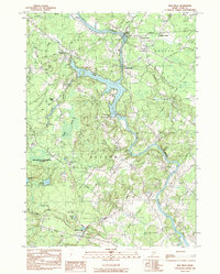
1983 Map of Bar Mills
USGS Topo · Published 1984About this map
The Saco River serves as the central artery of this region, shaping the industrial and social landscape of York County. Along its banks, the settlements of Bar Mills, Salmon Falls, and Union Falls mark points where the river's power was historically harnessed for local industry. Further inland, the map reveals a network of small village centers and crossroads including Hollis Center, Goodwins Mills, and Clarks Mills, which anchored the surrounding rural landscape.
Find a feature on this map
45 named features on this map. Tap any name to fly to it.
Don’t see what you’re looking for? This feature index may not catch every label — zoom into the map to look around manually.
Map Details
Editions of this 1983 Bar Mills Map
This is the sole edition of this map. No revisions or reprints were ever made.
Other maps of this area

1891 · Portland
USGS Topo · 1:62,500

1891 · Biddeford
USGS Topo · 1:62,500

1891 · Kennebunk
USGS Topo · 1:62,500

1891 · Buxton
USGS Topo · 1:62,500

1892 · Buxton
USGS Topo · 1:62,500

1893 · Kennebunk
USGS Topo · 1:62,500

1893 · Biddeford
USGS Topo · 1:62,500

1893 · Portland
USGS Topo · 1:62,500

1893 · Buxton
USGS Topo · 1:62,500

1898 · Kennebunk
USGS Topo · 1:62,500