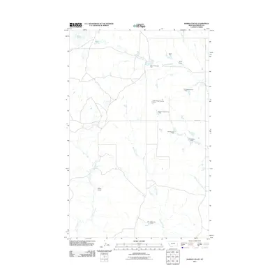
2011 Map of Barber Coulee
USGS Topo · Published 2011About this map
Barber Coulee and Scott Coulee define the drainage patterns of this Phillips County landscape, where the management of water is central to the land's utility. The area is characterized by an extensive network of small-scale water control features, including the Second Telegraph Dam and various structures named for local landholders like the William Knight Number 1 Dam and R Pankratz Number 1 Dam. These reservoirs and dams, such as None Dam, suggest a long history of cattle ranching and agricultural adaptation in this arid part of Montana.
Find a feature on this map
19 named features on this map. Tap any name to fly to it.
Don’t see what you’re looking for? This feature index may not catch every label — zoom into the map to look around manually.
Map Details
Editions of this 2011 Barber Coulee Map
This is the sole edition of this map. No revisions or reprints were ever made.
Other maps of this area

1954 · Jordan
USGS Topo · 1:250,000

1954 · Lewistown
USGS Topo · 1:250,000

1956 · Jordan
USGS Topo · 1:250,000

1958 · Jordan
USGS Topo · 1:250,000

1959 · Lewistown
USGS Topo · 1:250,000

1964 · Jordan
USGS Topo · 1:250,000

1965 · Karsten Coulee
USGS Topo · 1:24,000

1965 · Veseth Reservoir
USGS Topo · 1:24,000

1965 · Dry Fork Ridge
USGS Topo · 1:24,000
1965 · Holzhey Reservoir
USGS Topo · 1:24,000