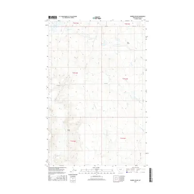
2017 Map of Barber Coulee
USGS Topo · Published 2017About this map
Shed Lake and Beam Lake sit at the northern edge of this high plains landscape, where drainage patterns are defined by a network of seasonal coulees and creeks. The terrain is deeply etched by Scott Coulee and Barber Coulee, while water flows through systems like Fourchette Cr and the Dry Fork Cr. This 2017 survey reflects the remote character of Phillips County, where the grid of the Public Land Survey System meets an environment dominated by natural hydrology rather than dense settlement. The limited road network, including Midale Rd and Dry Fork Rd, underscores the isolation of the area, primarily serving the ranching interests and land management needs of this Montana interior.
Find a feature on this map
18 named features on this map. Tap any name to fly to it.
Don’t see what you’re looking for? This feature index may not catch every label — zoom into the map to look around manually.
Map Details
Editions of this 2017 Barber Coulee Map
This is the sole edition of this map. No revisions or reprints were ever made.
Other maps of this area

1954 · Jordan
USGS Topo · 1:250,000

1954 · Lewistown
USGS Topo · 1:250,000

1956 · Jordan
USGS Topo · 1:250,000

1958 · Jordan
USGS Topo · 1:250,000

1959 · Lewistown
USGS Topo · 1:250,000

1964 · Jordan
USGS Topo · 1:250,000

1965 · Karsten Coulee
USGS Topo · 1:24,000

1965 · Veseth Reservoir
USGS Topo · 1:24,000

1965 · Dry Fork Ridge
USGS Topo · 1:24,000
1965 · Holzhey Reservoir
USGS Topo · 1:24,000