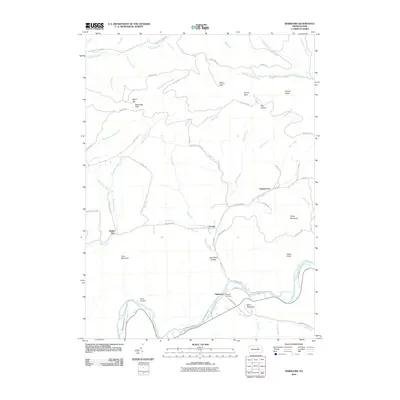
2010 Map of Barbours
USGS Topo · Published 2010About this map
Loyalsock Creek winds through this northern Pennsylvania landscape, anchoring a network of remote settlements and steep ridgelines. The small community of Proctor sits at the junction of Plunketts Creek and King Run, while Barbours and Hoppestown occupy high-ground positions further east. This 2010 topographic record highlights the lasting influence of resource extraction and forestry, seen in place names like Coal Mine Hollow and the presence of the Sprout Point Fire Tower. High-elevation landmarks such as Sharp Top Vista and Scalte Knob provide a sense of the vertical terrain, while the Whipple Cemetery offers a specific point of interest for genealogists tracking local families. A complex web of forest roads, including Pleasant Stream Rd and Cascade Rd, connects these isolated valleys, tracing the paths of earlier timber or coal routes that define the area's geography.
Find a feature on this map
70 named features on this map. Tap any name to fly to it.
Don’t see what you’re looking for? This feature index may not catch every label — zoom into the map to look around manually.
Map Details
Editions of this 2010 Barbours Map
This is the sole edition of this map. No revisions or reprints were ever made.
Other maps of this area

1927 · Eagles Mere
USGS Topo · 1:48,000

1930 · Warrensville
USGS Topo · 1:62,500

1932 · Eagle Mere
USGS Topo · 1:62,500

1934 · Warrensville
USGS Topo · 1:62,500

1942 · Canton
USGS Topo · 1:62,500

1943 · Powell
USGS Topo · 1:62,500

1944 · Canton
USGS Topo · 1:62,500

1945 · Powell
USGS Topo · 1:62,500

1953 · Warrensville
USGS Topo · 1:62,500

1953 · Eagles Mere
USGS Topo · 1:62,500
Featured Places
- Hillsgrove Township, PA
- Wallis Run, Cascade Township
- Fox Township, PA
- Proctor, Plunketts Creek Township
- Cascade Township, PA