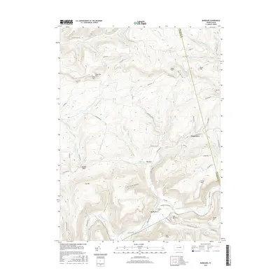
2016 Map of Barbours
USGS Topo · Published 2016About this map
Loyalsock Creek carves a deep valley through this Pennsylvania landscape, serving as the primary drainage for numerous steep-sided hollows and ridges. The settlement of Barbours sits at the junction of the creek and Plunketts Cr, near the Whipple Cem. The terrain is defined by dramatic elevation changes, with named peaks like Sharp Top, Camp Mtn, and Cove Mtn rising above the stream beds.
Find a feature on this map
73 named features on this map. Tap any name to fly to it.
Don’t see what you’re looking for? This feature index may not catch every label — zoom into the map to look around manually.
Map Details
Editions of this 2016 Barbours Map
This is the sole edition of this map. No revisions or reprints were ever made.
Other maps of this area

1927 · Eagles Mere
USGS Topo · 1:48,000

1930 · Warrensville
USGS Topo · 1:62,500

1932 · Eagle Mere
USGS Topo · 1:62,500

1934 · Warrensville
USGS Topo · 1:62,500

1942 · Canton
USGS Topo · 1:62,500

1943 · Powell
USGS Topo · 1:62,500

1944 · Canton
USGS Topo · 1:62,500

1945 · Powell
USGS Topo · 1:62,500

1953 · Warrensville
USGS Topo · 1:62,500

1953 · Eagles Mere
USGS Topo · 1:62,500
Featured Places
- Hillsgrove Township, PA
- Wallis Run, Cascade Township
- Fox Township, PA
- Proctor, Plunketts Creek Township
- Cascade Township, PA