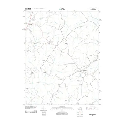
2011 Map of Barboursville
USGS Topo · Published 2011About this map
The Rapidan River forms the northeastern boundary of this Virginia landscape, where the foothills of the Southwest Mountains meet several historical settlements. Barboursville serves as a focal point in the east, characterized by the Barboursville Winery and proximity to Hardwick Mountain. To the west, the crossroads of Ruckersville and Newtown show the ongoing development of local infrastructure alongside established agricultural lands. This survey captures a rural environment defined by numerous family and community landmarks, including Dickensons Store and a high density of small burial grounds like Mount Lebanon Cemetery and Knights Chapel Cemetery.
Find a feature on this map
82 named features on this map. Tap any name to fly to it.
Don’t see what you’re looking for? This feature index may not catch every label — zoom into the map to look around manually.
Map Details
Editions of this 2011 Barboursville Map
This is the sole edition of this map. No revisions or reprints were ever made.
Other maps of this area

1892 · Gordonsville
USGS Topo · 1:125,000

1930 · Madison
USGS Topo · 1:48,000

1933 · Madison
USGS Topo · 1:62,500

1935 · Charlottesville
USGS Topo · 1:62,500

1939 · Charlottesville
USGS Topo · 1:62,500

1949 · Charlottesville
USGS Topo · 1:250,000

1949 · Charlottesville
USGS Topo · 1:62,500

1956 · Charlottesville
USGS Topo · 1:250,000

1961 · Gordonsville
USGS Topo · 1:62,500

1961 · Rapidan
USGS Topo · 1:62,500