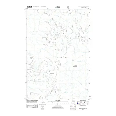
2011 Map of Bare Mountain
USGS Topo · Published 2011About this map
Bare Mountain and its surrounding peaks define this high-elevation landscape within the Gifford Pinchot National Forest as it was surveyed in 2011. The topography is dominated by a complex network of ridges and drainage basins, where Siouxon Creek and Trapper Creek collect water from numerous named tributaries like Calamity Creek and Big Hollow Creek. Human activity is primarily limited to forest management and recreation, evidenced by an extensive system of National Forest Development Roads, including Siouxon Rd and Nat For Dev Rd 54. Notable high-country landmarks include the Observation Peak Lookout and the secluded Soda Peaks Lake. The presence of the Observation Berryfield Campground near Observation Peak highlights the area's use for seasonal harvesting and outdoor access. This map provides a precise record of the trail-less summits and forest corridors before recent shifts in management or landscape change.
Find a feature on this map
38 named features on this map. Tap any name to fly to it.
Don’t see what you’re looking for? This feature index may not catch every label — zoom into the map to look around manually.
Map Details
Editions of this 2011 Bare Mountain Map
This is the sole edition of this map. No revisions or reprints were ever made.
Other maps of this area

1919 · Mount St Helens
USGS Topo · 1:125,000

1926 · Steamboat Mtn
USGS Topo · 1:125,000

1926 · Hood River
USGS Topo · 1:125,000

1929 · Hood River
USGS Topo · 1:125,000

1931 · Steamboat Mtn
USGS Topo · 1:125,000

1940 · Lookout Mtn
USGS Topo · 1:62,500

1948 · Vancouver
USGS Topo · 1:250,000

1950 · Vancouver
USGS Topo · 1:250,000

1950 · Vancouver
USGS Topo · 1:250,000

1950 · Yakima
USGS Topo · 1:250,000