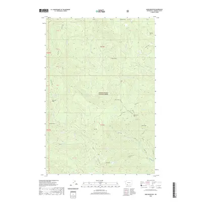
2020 Map of Bare Mountain
USGS Topo · Published 2020About this map
Gifford Pinchot National Forest dominates this section of the Cascade Range, defined by its complex network of ridges and glacial drainages. Significant vertical relief is anchored by summits such as Bare Mtn and Observation Peak, with drainage patterns formed by Chinook Creek and Trapper Cr. The presence of several named peaks including Calamity Peak and Timbered Peak indicates a landscape historically utilized for lookout points and forest management.
Find a feature on this map
48 named features on this map. Tap any name to fly to it.
Don’t see what you’re looking for? This feature index may not catch every label — zoom into the map to look around manually.
Map Details
Editions of this 2020 Bare Mountain Map
This is the sole edition of this map. No revisions or reprints were ever made.
Other maps of this area

1919 · Mount St Helens
USGS Topo · 1:125,000

1926 · Steamboat Mtn
USGS Topo · 1:125,000

1926 · Hood River
USGS Topo · 1:125,000

1929 · Hood River
USGS Topo · 1:125,000

1931 · Steamboat Mtn
USGS Topo · 1:125,000

1940 · Lookout Mtn
USGS Topo · 1:62,500

1948 · Vancouver
USGS Topo · 1:250,000

1950 · Vancouver
USGS Topo · 1:250,000

1950 · Vancouver
USGS Topo · 1:250,000

1950 · Yakima
USGS Topo · 1:250,000